Geo: Bristol Hoppers glacial geology walk
Connecticut geologist Greg McHone led a group of amateur geologists, hikers, and outdoors enthusiasts on a glacial geology walk through the City of Bristol's Hoppers-Birge Pond Nature Preserve Sunday. Hours after Saturday's downpours relented, the clouds parted to reveal a spectacular spring day, perfect for viewing the hoppers, eskers and glacial till left behind when the Laurentide Ice Sheet melted out of the area some 17,000 years ago.
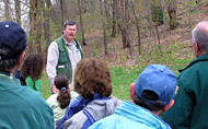
(Greg McHone, the author of "Great Day Trips to Discover the Geology of Connecticut," describes the geologic history of Connecticut and the glacial geology of the City of Bristol Hoppers-Birge Pond Nature Preserve. Photos courtesy of Greg McHone.)
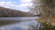
"This area is one of the best places in Connecticut to see some of these features," says Greg. Bristol residents voted overwhelmingly to establish the Hoppers-Birge Pond area as a preserve several years ago. The Mayor's Committee has been working to enhance its value to the community ever since. It cooperated with the State DEP to have the pond dredged, and also improves walkways and trails.
One of the most remarkable features of the Birge Pond Preserve is the glacial esker ridge running north-south along the area's western boundary. Glaciers melt from the bottom, Greg explained, and the melt water can form rivers that run beneath. As these glacial rivers flow beneath the ice, they can work to deposit a mix of the sand, gravel, and stones once frozen in the ice. This mix, known as glacial till, is laid down in a sort of "upside-down" river valley, or glacial esker, like the one that formed the ridge at the preserve.
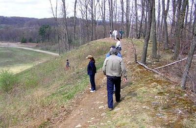
(The "upside-down" river valley that formed the esker ridge at the Hoppers-Birge Pond Nature Preserve is clearly seen hiking the trail that runs along its summit.)
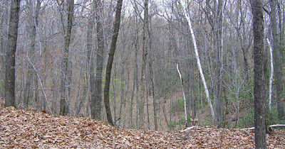
The name "Hoppers" comes from other large and dramatic features commonly found in and around the preserve. These large bowl-shaped depressions formed where sections of ice encountered physical barriers and became stranded. In places, large blocks of ice were retained and later came to be covered over with glacial till.
These blocks of ice have long since melted, but the spaces they once occupied, seen in the forms of large semi-circular craters known as hoppers or kettles, are unmistakable.
(A view from trailside across the top of one of the large "hoppers," bowl shaped depressions common in the preserve.)
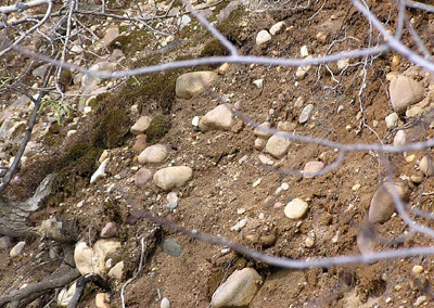
(The mixture of sand, gravel and stones, known as glacial till, that comprises the esker and much of the Hoppers-Birge Pond Nature Preserve, and is seen along the esker hillside.)
You wouldn't ordinarily expect to find pieces of brownstone, a sedimentary rock some 200 million years old, in an area of older metamorphic bedrock like the preserve. Yet, rounded fragments of brownstone of all different sizes are common in the glacial till of the Hoppers.
The source of the brownstone is easily spotted by looking east from atop the esker ridge, to where the area of the state's central lowlands can be seen just a few miles away.
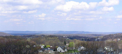
(The view to the east from atop the esker, across the Connecticut River Valley, toward its traprock ridges.)
As glacial ice rose up, out of the Connecticut Valley, it likely carried with it pieces of brownstone, eventually spreading these relatively young sedimentary rocks to the east and west of the valley, and across areas of much older bedrock, like that underlying the preserve, that is between 350 and 500 million years old.
posted by Brendan Hanrahan @ 4/26/2005 09:05:00 AM
0 comments
![]()
![]()
0 Comments:
Post a Comment
<< Home